Good Morning Kununurra!
Low 15°c (59°F) – High 32°c
(90°F)
I woke this morning coughing up half a lung full of smoke – just the
way you want to start the day. With no
chance of going back to sleep I got up to read and let the other two family
members get on with a bit more sleep.
Shane headed out early to pick up the rest of the groceries we needed,
most notably chickens for Kitty’s dinners while I did the usual morning
cleanup, make the bed etc. Once he
returned and breakfast was done and dusted we headed out just to see what the
local surrounds were like. Ivanhoe
Crossing is just on the outskirts of town and is a fascinating spot to watch
vehicles navigate the river crossing.
With warnings all around about Crocodiles being in the area we were a
little perplexed about one young man’s life decision to go fishing off the
roadway even if he was glancing around periodically to ensure there were no
crocs about to select him for dinner.
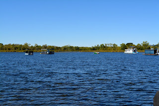
Lily Creek Lagoon is on the edge of the town, on the opposite side of
the Victoria Highway, a huge waterway that boasts fishing and lots of
birdlife.
From there we took a drive to Anzac Hill which has to be the saddest
and most neglected looking memorial in memory of those who served in war time
that I’ve ever seen.
Kununurra was initiated to service the Ord River Irrigation Scheme
and has an abundance of fresh water, conserved by the Ord River Diversion dam
and the main Ord River Dam which shows in the lush green grass and gardens
throughout the town. Farming includes
growing melons, mangoes and until recently, sugar cane. Farmers are now turning to a more lucrative
(though longer term) crop of Indian sandalwood. Other crops that
have been grown in the area are cotton, safflower and rice,
which is being trialed once again, having been the first crop planted on the
Pilot Farm in 1960. Tourism and mining
have also become important to the local economy. East Kimberley Regional Airport, commonly
referred to as Kununurra Airport, is located 3.7 km (2.3 mi) west of
the town centre. Heavy wet seasons often
result in this area being cut off from essential outside services and
deliveries and so the airport is a crucial piece of infrastructure which enables
people and goods to enter or leave from the region and especially supports
tourism and economic development.
The town itself has a really strange layout and to be honest at times
while we drove around the town centre it felt like we were going in circles. A look at the map confirmed that the township
is indeed not grid pattern but a series of semi circles. While driving around we did find an ice-cream
shop and decided to have a treat. A huge
selection of flavours made the decision very difficult and while they weren’t
cheap, they were certainly delicious. I
suspect we may have to drop by again before we leave.
Back to camp for a late lunch and I’ll be honest – all three of us had
a bit of a nanna nap. Another NRL match
to watch tonight with Melbourne Storm taking a win (YAY), and unfortunately the
return of smoke although not quite as bad as the night before.
Subscribe to:
Post Comments (Atom)
DAY 103 – Horsham - Colac
Good Morning Horsham! Low 4 °c (39°F) – High 18°c (64°F) 269km Total Trip - 19022km (11,820 miles) Well sadly this was the last few ho...

-
Good Morning Madura! Low 7 °c (45°F) – High 17°c (63°F) 378km WOW today was a huge day, not so much in terms of how many kilometers we t...
-
Good Morning Broome! Low 14 °c (57°F) – High 31°c (88°F) 40km Saturday morning and time to check out the market which was larger than we...
-
Good Morning Balladonia! Low 7 °c (45°F) – High 22°c (72°F) 337km Some early departures from camp this morning, there were so many vans,...


No comments:
Post a Comment