Good Morning Madura!
Low 7°c (45°F) – High 17°c
(63°F)
WOW today was a huge day, not so much in terms of how many kilometers
we travelled to get to our next overnight destination, but the number of stops
we made and what we saw today probably outdid any other of the 95 days of our
trip so far.
Given I had a really early night to bed last night I was awake pretty
early, as was Shane, and I guess the concern for this stupid abscess is really
playing on both our minds. On waking
this morning there was still swelling in the face although it did feel ever so
slightly less tight. The headaches and
nausea unfortunately are persisting which isn’t ideal for driving but we really
need to get to civilization before the antibiotics run out just in case…. But the advantage was we were packed and
heading out the gate just after 7.30am although far from the first to leave as
we heard cars leaving pre-dawn.
Being up early wasn’t particularly planned and we really hadn’t decided
on a destination for the day – just to drive until enough was enough. I’m so glad though because the early day lent
itself to lots of opportunities that we might not have otherwise taken up. It was a very foggy/hazy morning with the fog
not burning off until well into the morning. In keeping with the refuel at
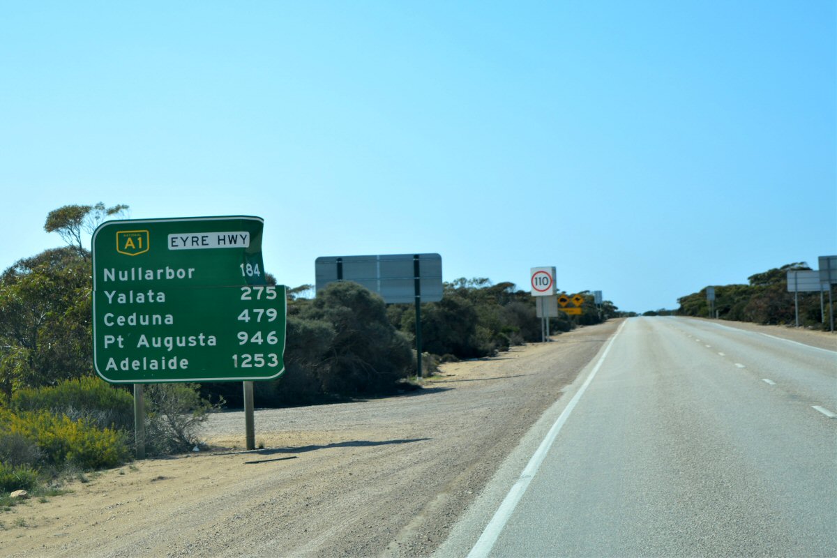
every opportunity, our first stop was Eucla which is the last “town” before the
South Australian border being just over half way from Perth to Adelaide. At the 2016 Australian census, Eucla had
a population of 53. It is the only
Western Australian location on the Eyre Highway that has a direct view of
the Great Australian Bight due to its elevated position immediately
next to the Eucla Pass – where the highway moves out and above the
basin known as Roe Plains that occurs between the Madura and Eucla
passes. The Hampton Tablelands
escarpment runs the entire length of the Roe Plains adjacent to the Eyre
Highway.
The name Eucla is believed to originate from an Aboriginal word
"Yinculyer" which one source gives as referring to the rising of the
planet Venus. In 1841, Eyre and Baxter became
the first European explorers to visit the area. In 1867, the president of the Marine Board of
South Australia declared a port at Eucla. In 1873, land was taken up at Moopina Station
near the present townsite, and work commenced on a telegraph line
from Albany to Adelaide. Land was set aside at Eucla for the
establishment of a manual repeater station, and when the telegraph line opened
in 1877, Eucla was one of the most important telegraph stations on the line as
a conversion point because South Australia and Victoria used American
Morse code (locally known as the Victorian alphabet) while Western
Australia used the international Morse code that is familiar today.
A jetty and tram line was constructed for offloading supplies brought
in by sea and the town was proclaimed a township and gazetted in 1885, reaching
its peak in the 1920s, prior to the construction of a new telegraph line
further north alongside the Trans-Australian Railway in 1929.
In the 1890s a rabbit plague passed through the area and ate
much of the Delisser Sandhills' dune vegetation, thus
destabilising the dune system and causing large sand drifts to encroach on the
townsite. The original town was
abandoned, and a new townsite established about 4 km to the north and
higher up on the escarpment. The ruins of the original telegraph station which
still stand amongst the dunes are a local tourist attraction and we took a
drive down the steep escarpment (caravan and all) to take a look. I’m surprised no-one has tried to remove some
of the sand around the building and we met a couple at the site who had visited
there about 40 years ago when the building was still intact and not engulfed by
sand. The really sad part is the senseless
defacing of the walls by people carving their names and initials into the
sandstone blocks and someone had even tagged a wall in black paint which
someone had tried to cover up with sandy coloured paint. It never ceases to amaze us why people think
it’s OK to deface historic sites like this.
Apparently many of the pioneer farmers and telegraph operators were
buried at Eucla, but as the sand dunes encroached onto their graves, some of
the headstones and plaques were removed and can now be seen at the museum at
Eucla. By the time we had refueled,
driven down to the telegraph station site and returned, we headed out onto the
highway and didn’t visit the museum.
In 1971, worldwide media publicity came to the town after reports (and
indistinct photographs) emerged of a half-naked blonde girl who had gone wild
and lived and ran with the kangaroos, who came to be known as the "Nullarbor
Nymph". The story subsequently turned out to be a hoax created by the
residents of the tiny settlement. Got to
love a good hook to get people to visit your town!
About 12km from Eucla it was GOODBYE WESTERN AUSTRALIA and HELLO SOUTH
AUSTRALIA! And what says “State Border”
better than a giant Kangaroo holding an equally giant jar of Vegemite! Shane was also lucky to capture the signpost
with a crow sitting on top of it. All
good Aussie stuff however it was time to adjust the watches an hour and a half
forward – a job that would wait until we hit the next camp.
Despite signs for Camels, Wombats and Kangaroos – this time it seems
having a race – we didn’t see a single one of them.
Our next stop was something I had really been looking forward to – the Great
Australian Bight Marine Park and the breathtaking cliffs along this part of the
coast. The Marine Park consists of two
sections occupying the ocean immediately adjoining the coastline up to a
distance of 3 nautical miles (5.6 km; 3.5 mi) and extending from
the Western Australia border in the west to a place known as the
Tchalingaby Sandhills in the east. The gap between the two sections is also a
protected area known as the Great Australian Bight Marine Park Whale
Sanctuary which was proclaimed on 22 June 1995 under the Fisheries
Act 1982 (SA). The national park is also part of the group of marine protected
areas which are located together in waters within Australian and South
Australian jurisdictions within the Great Australian Bight and which
is collectively known as the Great Australian Bight Marine Park.
The national park was proclaimed principally to protect the calving
waters of the Southern right whale and the Australian sea lion populations. This is also the longest continuous cliff
coast line in the Southern Hemisphere. It’s the epic meeting point of the
outback and the ocean. There are 1,160kms
of cliffs towering 60-120 metres (200-400 feet) high before dramatically
dropping into the Southern Ocean.
It was just after 12.00pm (still on WA time) when we pulled in to one
of the unofficial lookout areas, one of the dozens of rough tracks that lead
down to the edge of the cliffs and we decided it was a perfect spot for
lunch. What a view from the door and also
from the edge (although not too close to the edge). Back on the road, we pulled off into a few
more of these as well as visiting the three official lookouts, the last of
these providing a certain degree of entertainment with a car containing three
young men, one with a drone (I’m sure he had applied for the appropriate
permits), one with a camera with a very long lens, and one with an interesting paneled
“skirt”, no shirt and a penchant for dancing dangerously close to the edge
while being filmed and photographed. We
gather it was either for a film or promotion of some kind but it certainly isn’t
every day you run across such a scene.
A little further down the road and we started on the section that
really does scream Nullarbor with the start of the Nullarbor Plain part of the
area of flat, almost treeless, arid or semi-arid country. It is the world's largest single exposure
of limestone bedrock, and occupies an area of about 200,000 square km
(77,000 sq mi). At its widest point, it stretches about 1,100 km
(684 mi) from east to west across the border between South Australia and Western
Australia. Some agricultural interests
are on the fringe of the plain including the 2.5-million-acre
(1-million-hectare) Rawlinna Station, the largest sheep station in
the world, on the Western Australian side of the plain.
It was just before 5.00pm (SA time now – if you think we’re confused
spare a thought for Kitty at dinner time!) when we pulled in to the Nullarbor
Roadhouse, tonight’s destination, another iconic dot on the map. Both of us totally exhausted from the long
day, we got ourselves set up and one of the first places to visit was the
showers. And let me say they were
amazing and not just because we were so tired.
Feeling refreshed but not quite up to cooking we decided to indulge in “Nulla-burgers”
for dinner. All good things come in
threes – and we were treated to a spectacular outback sunset. The camp filled very quickly with late comers
being directed out the back to the unpowered section. It was a very quiet and peaceful night.


No comments:
Post a Comment